This is a retrospective blog of my seven-week exploration of Virginia along with a journey through the Shenandoah National Park and on down the Blue Ridge Parkway to Cherokee, North Carolina. 'Retrospective' means simply that it wasn't written during the trip, but is being written after-the-fact, a little over a year later. Baaswell Sheep accompanied me and is writing the blog in the way he's done my later blogs, since he's so good with the color commentary. Unfortunately, since I didn't plan for this blog back when I was doing the trip, my pictures are limited to the major attractions, but I'll try to make those galleries a little larger than I do in my later blogs.
Select/click any image to see it at double (or more) the current size. While viewing a large image, use the left and right arrow keys to view other images on this page. Select/click on the large image or any part of the darkened area, or press 'Escape', to return to the blog page. Note: Table of contents is now located at the bottom of the page.
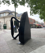
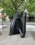
It's our last day on the Blue Ridge Parkway, but we first made a short stop in downtown Asheville to visit the Woolworths Walk art store (in an old Woolworths five-and-dime store) and have lunch at the Tupelo Honey restaurant, getting some of the best fried chicken out there. Asheville is known as an arts and crafts town, and the pictures below reflect that, showing the giant flatiron sculpture that sits on the street in front of the Flatiron Building. Interesting, right? In any case, after lunch, we went right on down to the south side of Asheville and got back on the Parkway via Biltmore Road, heading west towards Cherokee, NC through some of the most rugged sections of the Parkway.
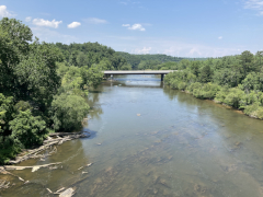
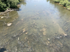
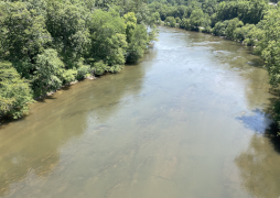
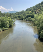
After the James River in Virginia, the French Broad River is one of the widest river crossings for the Parkway, and if you're willing to walk across the bridge you can get some great views of the river, as pictured below.
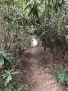
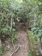
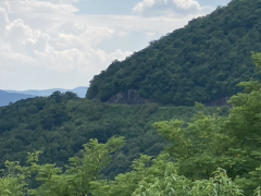
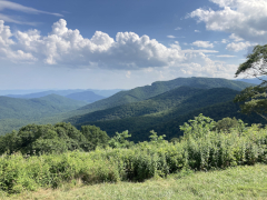
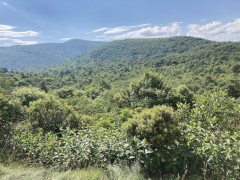
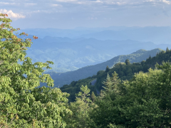
Pisgah Inn is one of two lodges that sit right on the Parkway, but unlike Peaks of Otter, which is managed by the National Park Service, Pisgah Inn is still a privately run business. The rooms were a little too pricy for us given our splurges earlier in the trip, but we stopped off for an hour and wandered around to see the views and get a sense of what all the place offers, with hopes we might could come back for a multi-night stay sometime in the future. The pictures below show the kind of plant life along one of the trails as well as the views from the back deck of the dining room / gift shop building. The last photo is a zoom-in on where the southbound Parkway runs alongside a neighboring ridge of the mountains.
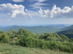
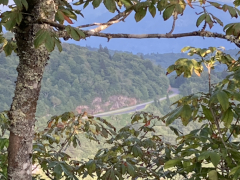
From this overlook just east of the Pisgah Inn you can see into the valley where the Cradle of Forestry is located. The Cradle of Forestry is the home of the first forestry school in the United States, created by George Vanderbilt when he bought the huge piece of land on which he built his mansion, known today as Biltmore Estate. Vanderbilt cared greatly about protecting the land and its forests, wanting to make use of the trees, but understanding that they have to be managed properly or there won't be any trees left in the future. As there were no forestry experts at the time, he brought over one from Europe and established the school with this man as the head instructor to train Americans to be able to manage and protect the forests. (My companion visited the Cradle of Forestry back in 2022, which is why he knew all of this background which he shared with me for formulating the post.)
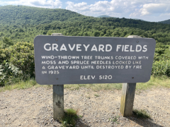
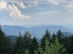
One of the more remarkable spots along the Parkway, Graveyard Fields gets it name because a massive natural forest fire destroyed all the trees in this area a little over a hundred years ago, and ecologically it's still recovering. The first regrowth was low lying shrubs and plants, which thrive once the taller trees are gone. Thus this large area looks notably different from your typical mountain top roadside view. Ecologists believe that in time large trees will start to grow again, which will shade the ground and reduce the population of shrubs and other plants that need lots of sunlight, returning the area to a more typical mountainside climate. But, it could be another century before that part of the recovery cycle is complete.
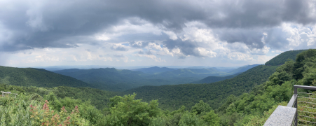
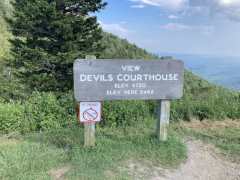
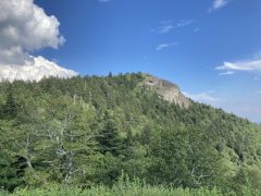
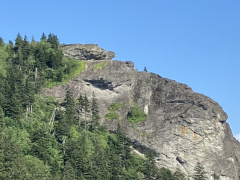
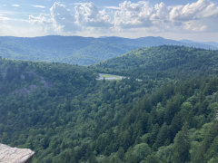
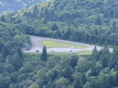
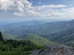
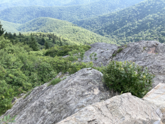
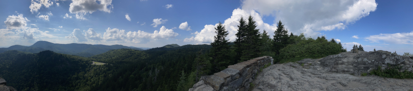
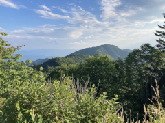
Here we went on our last big hike of our seven-week trip, ascending the trail up to the overlook known as Devil's Courthouse. The trail length was only about half a mile, but trust me, it was all uphill. The view was spectacular, the parking lot down below looking so tiny in the distance. This is definitely a worthwhile hike ... as long as the weather's good like it was for us.
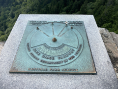
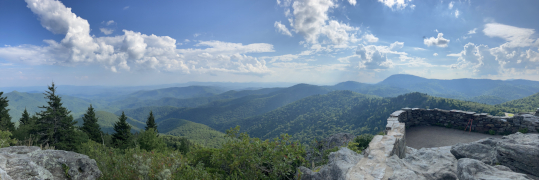
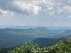
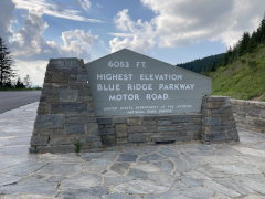
A short stop here, but I'd dare say that most travelers make this stop, for it's the highest elevation on the Parkway as the sign declares. The view here is not all that different from other points we've visited, but we took one picture anyway to commemorate the moment.
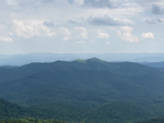
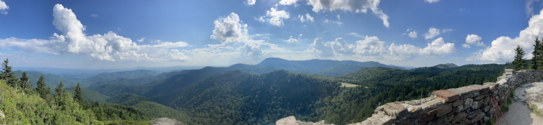
Alas, we've reached our last notable stop on the Blue Ridge Parkway. Technically there are still about fourteen more overlooks before the end, but none of them are that remarkable, and Waterrock is the last stop with a hiking trail or any feature of note. My companion wanted to hike up to the knob, but he was just too winded from ascending to the Devil's Courthouse and back, so he only made it up the paved trail about a tenth of a mile to where the pavement ended (all uphill, by the way) then returned to the van. It's been quite an adventure traveling down the Blue Ridge Parkway, and I wish we could have enjoyed the section in northern North Carolina that was closed, but nothing we could do about that. Maybe next time it will be open and we can put some extra focus on it. For now, we've gone down into Cherokee and west ten miles to Bryson City, where we'll be staying in a bed and breakfast for the next few nights as we recover from all of this hiking and my companion catches up on his missed work (he took vacation time since Independence Day, so now he has a nicely stuffed email box to sift through.) Our vacation trip is not over, though, as we still have six more days and nights before we return home.
Please note that all restaurant and product names are used simply for referential purposes and links provided as a courtesy. Reviews are the sole opinions of the reviewer: no restaurant has paid to be listed here, and no restaurant is being explicitly endorsed. In other words, go out there, try them all, and form your own opinions!
All original content ©2025 Kevin Pittman and may not be reused without permission