This is a retrospective blog of my seven-week exploration of Virginia along with a journey through the Shenandoah National Park and on down the Blue Ridge Parkway to Cherokee, North Carolina. 'Retrospective' means simply that it wasn't written during the trip, but is being written after-the-fact, a little over a year later. Baaswell Sheep accompanied me and is writing the blog in the way he's done my later blogs, since he's so good with the color commentary. Unfortunately, since I didn't plan for this blog back when I was doing the trip, my pictures are limited to the major attractions, but I'll try to make those galleries a little larger than I do in my later blogs.
Select/click any image to see it at double (or more) the current size. While viewing a large image, use the left and right arrow keys to view other images on this page. Select/click on the large image or any part of the darkened area, or press 'Escape', to return to the blog page. Note: Table of contents is now located at the bottom of the page.
We ended up spending last night up in an area called Oyster Pointe. In spite of having been out here a number of times when he was a child, my companion is finding there's far more to the Hampton Roads area than he ever knew about, though of course the area has grown by leaps and bounds over the years, too. This morning, we returned to the area he was familiar with along Mercury Boulevard, and visited a little blast from the past.
My companion says he's not sure he ever knew the name of this place when he was a child – it was just the place they'd bring him to see the big space rockets and play on the playground. Thus, is was amusing to him to talk with the fellow at the front desk and reveal how he had come there as a child those many years ago (no, I'm not going to reveal his age). The fellow told him that the museum actually closed for about a decade, the outdoor rockets left in place, but the building used by the city recreation service as office space. And then, a decision was made to reopen the museum, and today there's a city greenspace and riverwalk trail adjoining it. We went around the inside areas first, then went out and looked at all of the rockets. Sadly, the ones you could climb on were removed, for, as the fellow at the front desk told us, some kid got himself stuck in one of them and they had to call the fire department out. Isn't that how it always goes? Still, my companion said it was quite a treat to revisit the place, and afterwards we walked a ways on the riverwalk, though it was starting to get pretty warm out, so we couldn't go far.
We were going to eat here last night, but we couldn't get into the building with the huge group of school athletes there. So, we went back today to find a more managed crowd. This place serves chicken fingers and is similar to Zaxby's, only Raising Cane's doesn't sell wings – just tenders. They're not bad according to my companion, and the iced tea was very refreshing. We loved the advertising campaign there: they somehow got the rapper/actor Ice-T to endorse their iced tea, so they have these big printed cards in front of the urns: Ice-T smiling in a welcoming manner on the sweet iced tea urn, and Ice-T frowning with his arms folded on the unsweet iced tea urn. I wanted my companion to take a picture, but we could never find a good time to get a clear shot of it.
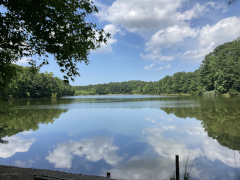
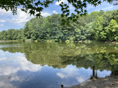
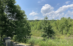
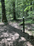
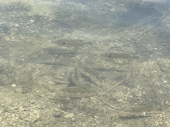
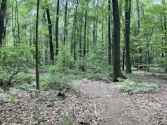
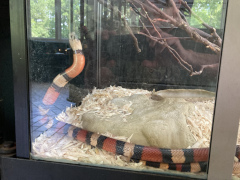
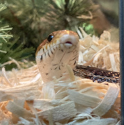
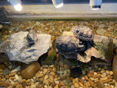
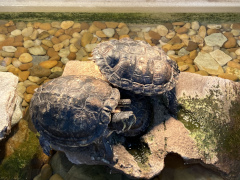
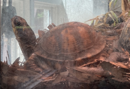
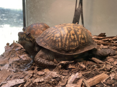
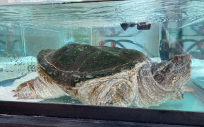
Located just west of I-64 on Hampton Roads Parkway, the Sandy Bottom Nature Preserve is a large collection of trails all named for different plants and animals. We did a combination of the Fallen Oak trail and the Red Fox trail, the former running alongside Crystal Lake. We did about 1.6 miles in all, and would have gladly done more if the temperatures hadn't been up in the upper 90s again. If you should visit here, be sure to go in the nature center, as they have a variety of animals on display in there: snakes, turtles, etc.
The Journey to Orange, Virginia
Our next destination is back in central Virginia near the little town of Orange. Orange is north of Charlottesville, and the attraction nearby is Monticello, the home of our fourth president, James Madison. But, more about that tomorrow. Today, we had to journey 173 miles, and we probably should have gone the route I suggested, but no, my companion wanted to take the scenic route, returning to Williamsburg and taking scenic highway VA 5 up to the southeastern edge of Richmond, then missing the turn he meant to take and ending up crossing the James river via the Pocahantas Parkway and bridge at cost of a $6 toll. Ah well, it's his money, not mine. That put us on Chippenham Parkway, where one of his relatives used to live. We went out to Hugenot Rd and then got on VA 11 that took us westward into the countryside, paralleling I-64 more or less for a good ways. We then took US 522 to US 250 to US 15 north to Orange, where we found an interesting privately run hotel with a Hampton Inn or Fairfield kind of feel to it. We grabbed a bite to eat at a Subway and then settled in for a good night's rest, as we had a historic home to tour the next day, and even more fun to come after that.
Please note that all restaurant and product names are used simply for referential purposes and links provided as a courtesy. Reviews are the sole opinions of the reviewer: no restaurant has paid to be listed here, and no restaurant is being explicitly endorsed. In other words, go out there, try them all, and form your own opinions!
 My companion says he's not sure he ever knew the name of this place when he was a child – it was just the place they'd bring him to see the big space rockets and play on the playground. Thus, is was amusing to him to talk with the fellow at the front desk and reveal how he had come there as a child those many years ago (no, I'm not going to reveal his age). The fellow told him that the museum actually closed for about a decade, the outdoor rockets left in place, but the building used by the city recreation service as office space. And then, a decision was made to reopen the museum, and today there's a city greenspace and riverwalk trail adjoining it. We went around the inside areas first, then went out and looked at all of the rockets. Sadly, the ones you could climb on were removed, for, as the fellow at the front desk told us, some kid got himself stuck in one of them and they had to call the fire department out. Isn't that how it always goes? Still, my companion said it was quite a treat to revisit the place, and afterwards we walked a ways on the riverwalk, though it was starting to get pretty warm out, so we couldn't go far.