This is a retrospective blog of my seven-week exploration of Virginia along with a journey through the Shenandoah National Park and on down the Blue Ridge Parkway to Cherokee, North Carolina. 'Retrospective' means simply that it wasn't written during the trip, but is being written after-the-fact, a little over a year later. Baaswell Sheep accompanied me and is writing the blog in the way he's done my later blogs, since he's so good with the color commentary. Unfortunately, since I didn't plan for this blog back when I was doing the trip, my pictures are limited to the major attractions, but I'll try to make those galleries a little larger than I do in my later blogs.
Select/click any image to see it at double (or more) the current size. While viewing a large image, use the left and right arrow keys to view other images on this page. Select/click on the large image or any part of the darkened area, or press 'Escape', to return to the blog page. Note: Table of contents is now located at the bottom of the page.
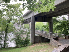
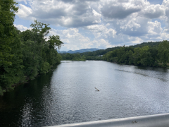
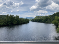
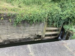
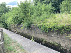
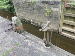
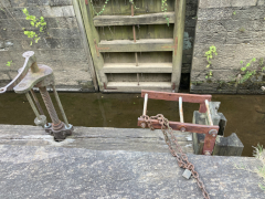
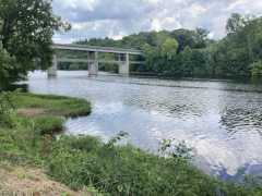
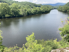
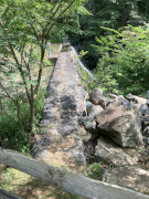
After a grab-and-go brunch, we set off back to the north to revisit the James River Visitor's Center and get a close-up view of the river itself. The crossing of of James River is the lowest point of the Blue Ridge Parkway, and between the lower altitude and the river setting, you can feel the difference in climate between here and the majority of the Parkway that is up on the mountain ridges. At this point, the James is not nearly as wide as it is in Richmond and eastward out towards the ocean, but it's still a nice, moderate size river. The visitor's center is small, but on the grounds is a preserved section of a canal that used to run alongside the river. There's also a small, modern, pedestrian pier under the Parkway bridge, letting you get out over the water and look up and down the river, and a Trail of Trees hiking trail that runs about a mile through the nearby woods.
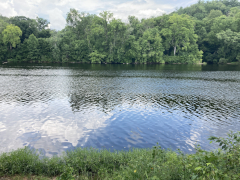
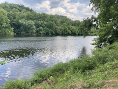
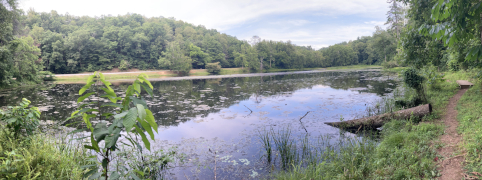
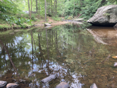
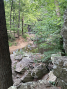
We went a little further north to Otter Lake and checked out a hiking trail here that loops around the lake. My companion had a little mishap in not being able to figure out where the trail ran at one point, but it really wasn't his fault: the markings were pretty hard to interpret, and when he finally figured it out he had to admit that it ran in a really odd arrangement there. He made it the rest of the way around with no problems and got some nice views of the lake along the way.

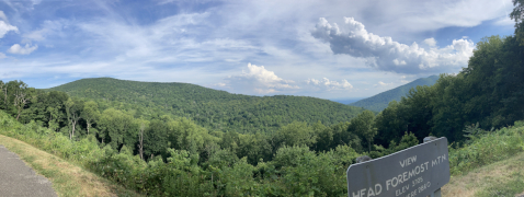
Let's just face facts: some of these mountains and valleys have really odd names. Really odd. But, the view at Head Foremost Mountain was quite nice – so nice that after making a brief stop there on the way north, we decided to stop again and get some more pictures on the way back to Peaks of Otter.
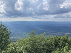
Thunder Ridge
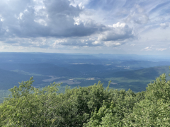
Head Foremost Mountain
We returned to the lodge for the late afternoon and evening, having dinner at the main dining room, getting a chicken pot pie for my companion and a salad for me. It's been amazing up here, and I hate thinking about having to leave tomorrow, but we still had the rest of the evening to enjoy, and plenty more Blue Ridge Parkway to explore in the days ahead.
Please note that all restaurant and product names are used simply for referential purposes and links provided as a courtesy. Reviews are the sole opinions of the reviewer: no restaurant has paid to be listed here, and no restaurant is being explicitly endorsed. In other words, go out there, try them all, and form your own opinions!
All original content ©2025 Kevin Pittman and may not be reused without permission